My name is Kévin , founder of Modern-Map , a brand born in 2021 with a simple idea: to offer world maps that are both beautiful and educational .
Geography has always inspired me. As a child, I would spend hours in front of school wall maps or my grandfather's globe, exploring the world with my eyes. This passion has never left me.
So today, after several years of work, I design and sell maps designed as real wall objects: clear, aesthetic and useful , for learning, dreaming or simply decorating an interior with meaning.
Modern-Map is much more than a graphic design project: it's the result of thousands of hours of research, design, editorial choices, and testing. My ambition? To create world maps that inspire learning —and that naturally find their place in a classroom , a child's bedroom , a living room , or a bookstore .
❓ Why a world map? Because it opens the mind.
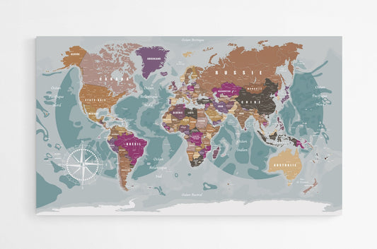
A wall map isn't just a decorative object. It's a terrestrial fresco that tells the story of our planet. It allows you to visualize all countries and, depending on the model, the reliefs, seas, political boundaries, and capitals. Whether you're looking to locate a North American country, discover the contours of Europe, or compare the surface areas of continents, a world map offers you a comprehensive and immersive reading experience!
To create my maps, I use the Van der Grinten projection , a cartographic method developed in the late 19th century by the cartographer Alphons van der Grinten, which offers an excellent compromise between geographical fidelity and spherical aesthetics. This projection is ideal for creating a beautiful wall map, as it preserves the proportions while offering a harmonious shape, perfect for intuitive visual reading.
My cards are therefore designed to appeal to teachers, parents, the curious, globetrotters, in short to anyone who wants to integrate a strong graphic element into their interior decoration.
🌐 Interactive World Map: a unique innovation
One of my best ideas is the interactive map. I'm integrating a small QR code, hidden in the compass rose, which gives access to the Worldometer website, a fascinating site where you can track in real time the world's population, global GDP, languages spoken, life expectancy, satellite data on the environment, and much more.
Even better: this QR code can be personalized. You can link it to a travel photo album, a video, a web page, or a personal message. It's a poetic way to connect your wall map to your own story. Each copy becomes a unique piece, somewhere between a work of art and a living memory.
🇫🇷🇯🇵🇧🇷🇨🇦🇿🇦 Political world maps: with or without flags
I offer two main families of political maps according to your style or your needs:
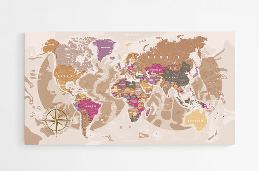
🏳️ Country Maps with Flags : These include all up-to-date national flags, positioned at the bottom of the map, all in alphabetical order. This is an excellent tool for visually learning to recognize nations and their emblems. These educational maps are particularly popular in schools, cultural centers, or educational offices.
🎨 Clean world maps : These versions do not include flags or Antarctica, if you prefer. They are designed for lovers of minimalist design, which is very popular in Scandinavian or contemporary interiors. They leave room for color, typography, and graphic balance without overloading the visual space.
🗣️ Multilingual political planispheres: to explore without borders(Coming soon)
Because the world is multilingual, I launched a series of World Atlases translated into several languages: French, English, Spanish, German, and Italian. Whether for learning, teaching, or simply decorating a bilingual space.
These maps with the different countries of the world exist with or without national flags, in board, poster or large format, perfect for international schools, language classes or multicultural families.
📚 Geography becomes child's play!
I also offer world maps for children, designed to captivate young children with bright colors, playful illustrations, and iconic landmarks. Ideal for learning to locate the continents, oceans, and countries of the globe. It's an incredible educational tool for raising awareness from elementary school onward.
🖍️ Also discover country maps to color: fun learning
I've designed a range of world maps to color, making learning geography fun. Printed in large format, they allow children (and adults) to color in each country, each continent, and even invent their own legends.
This is a great idea for holidays, birthdays, or simply to turn a learning session into a relaxing time.
I designed my school world maps with all educational uses in mind. They are rich in geographical content, yet still readable from a distance, thanks to careful work on the contrast and size of the typography.
They allow you to teach key information about the globe in a clear and visual way, and thus discover each country in the world.
The 195 countries of the world with their capitals
Ocean area
Land area
Circumference of the equator
Area and population of the 6 continents
Surface area and volume of the 5 oceans
Number of human beings on the globe
Life expectancy of the world population
Number of languages spoken
Number of religions
World GDP
Available in several formats, they will be ideal for middle schools, high schools, preparatory classes or home lessons.
I also offer blank world maps, widely used by teachers for tests or practical exercises. These planispheres are deliberately kept simple: no mention of countries or capitals. The idea is to give the student or user the opportunity to complete the map, by adding names, boundaries, or even numerical data.
It's an extremely powerful tool for active learning, self-assessment, or even for organizing a family geography quiz. Some people also use it as a decorative element to personalize, for example by coloring in the countries they've visited.
My wall world maps are printed in France, Germany, and the Netherlands. Each medium has been tested and selected for its quality . I have chosen to work with several European and French printers to guarantee you the best possible balance between print quality, price, delivery times, and after-sales service.
Here are the different supports:
200gsm Coated Matte Paper : economical and ideal if you want to frame the world map with the frame of your choice.
Magnetic Poster : flexible support, perfect for hanging your souvenirs, notes and travel photos or marking past or future destinations.
Plexiglas board : light and unbreakable, it fits perfectly into your interior, bringing color and knowledge.
🛒 Order your wall map at modern-map.com
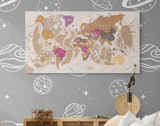
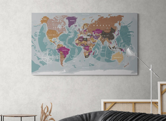
If you are looking for a large world map that is elegant, accurate, useful, and inspiring, I invite you to discover my entire collection at modern-map.com . You will find:
Interactive maps
XXL wall maps
World map posters or paintings
Blank cards, school cards and coloring cards
Whether you're an XXL poster or a decorative canvas, each piece is designed to enrich your daily life, stimulate curiosity, and open a window on the world. Whether you're a teacher, a parent, a globetrotter, or simply a cartography enthusiast, at Modern-Map you'll find the wall planisphere that suits you.
Use left/right arrows to navigate the slideshow or swipe left/right if using a mobile device
Choosing a selection results in a full page refresh.
Samah El Sayed Mohamad
Magnifique
La carte est tres belle, on reçoit ce qu’on commande sur le site, qualité tres bonne et le service et suivi de Kevin sont super
Carte du monde 2025
denis vautier
Belle carte
Belle carte agréable à regarder. Bon service de livraison.
Grand planisphère politique
JohnDoe
Test
test test
Planisphère décoratif magnétique
Carine GADIOUX PACE
très satisfaisaite
Carte du monde détaillée et en français, c'est très appréciable car introuvable ailleurs, reçue très rapidement et bien protégée, 150x90 en version poster, le papier n'est pas très épais mais cela reste néanmoins suffisant, accrochée avec du double face. Je suis très satisfaite de mon achat.
Carte mondiale en français
frédéric touron
Parfait
Papier haute densité.
Emballage soigné.
Livraison rapide pour Noël en 72h00 après mon clic.